
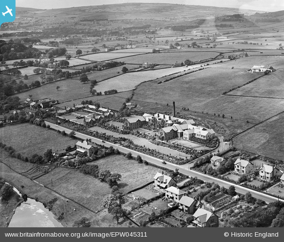
EPW045311 ENGLAND (1934). The Hartley Hospital, The Hartley Homes and surrounding countryside, Colne, from the south-east, 1934
© Hawlfraint cyfranwyr OpenStreetMap a thrwyddedwyd gan yr OpenStreetMap Foundation. 2026. Trwyddedir y gartograffeg fel CC BY-SA.
Delweddau cyfagos (6)
EPW045311

EPW045310

EPW045313

EPW045309

EPW045312

EPW045314

Manylion
| Pennawd | [EPW045311] The Hartley Hospital, The Hartley Homes and surrounding countryside, Colne, from the south-east, 1934 |
| Cyfeirnod | EPW045311 |
| Dyddiad | July-1934 |
| Dolen | |
| Enw lle | COLNE |
| Plwyf | COLNE |
| Ardal | |
| Gwlad | ENGLAND |
| Dwyreiniad / Gogleddiad | 391569, 440654 |
| Hydred / Lledred | -2.1282085315705, 53.86183010082 |
| Cyfeirnod Grid Cenedlaethol | SD916407 |
Pinnau
Byddwch y cyntaf i ychwanegu sylw at y ddelwedd hon!