
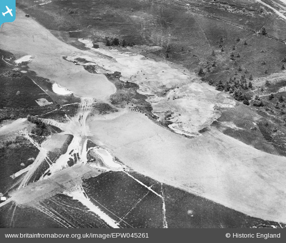
EPW045261 ENGLAND (1934). Land Drainage on Sunningdale Golf Course, Brick Hill, 1934
© Hawlfraint cyfranwyr OpenStreetMap a thrwyddedwyd gan yr OpenStreetMap Foundation. 2026. Trwyddedir y gartograffeg fel CC BY-SA.
Delweddau cyfagos (3)
EPW045261

EPW045255

EPW045258

Manylion
| Pennawd | [EPW045261] Land Drainage on Sunningdale Golf Course, Brick Hill, 1934 |
| Cyfeirnod | EPW045261 |
| Dyddiad | July-1934 |
| Dolen | |
| Enw lle | BRICK HILL |
| Plwyf | CHOBHAM |
| Ardal | |
| Gwlad | ENGLAND |
| Dwyreiniad / Gogleddiad | 495390, 165400 |
| Hydred / Lledred | -0.62921879808513, 51.37912946301 |
| Cyfeirnod Grid Cenedlaethol | SU954654 |
Pinnau
Byddwch y cyntaf i ychwanegu sylw at y ddelwedd hon!
Cyfraniadau Grŵp
Looks like the 4th and 12th greens on the new course, from the southeast. |

Tony D |
Tuesday 2nd of July 2013 12:52:03 PM |
It's a tricky one Tony but I'm happy with the suggested NGR. We'll update the catalogue and post the new record here in due course. Yours, Katy Britain from Above Cataloguing Team Leader |
Katy Whitaker |
Tuesday 2nd of July 2013 12:52:03 PM |