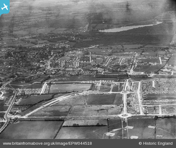
EPW044518 ENGLAND (1934). Construction of the Ruislip Manor Estate at Victoria Road and environs, Ruislip, 1934
© Hawlfraint cyfranwyr OpenStreetMap a thrwyddedwyd gan yr OpenStreetMap Foundation. 2026. Trwyddedir y gartograffeg fel CC BY-SA.
Manylion
| Pennawd | [EPW044518] Construction of the Ruislip Manor Estate at Victoria Road and environs, Ruislip, 1934 |
| Cyfeirnod | EPW044518 |
| Dyddiad | May-1934 |
| Dolen | |
| Enw lle | RUISLIP |
| Plwyf | |
| Ardal | |
| Gwlad | ENGLAND |
| Dwyreiniad / Gogleddiad | 509719, 187266 |
| Hydred / Lledred | -0.41659314248911, 51.573096523604 |
| Cyfeirnod Grid Cenedlaethol | TQ097873 |
Pinnau

Dave |
Saturday 6th of February 2021 09:55:12 PM | |

Nick |
Saturday 15th of March 2014 08:44:55 PM | |

Nick |
Saturday 15th of March 2014 08:44:18 PM | |

Nick |
Saturday 15th of March 2014 08:43:37 PM | |

Jessicasrider |
Saturday 24th of August 2013 11:03:58 PM |
Cyfraniadau Grŵp
This storage site was used up until about 1920. |

Nick |
Saturday 15th of March 2014 08:47:14 PM |


![[EPW044518] Construction of the Ruislip Manor Estate at Victoria Road and environs, Ruislip, 1934](http://britainfromabove.org.uk/sites/all/libraries/aerofilms-images/public/100x100/EPW/044/EPW044518.jpg)
![[EPW044193] Housing under construction around Shenley Avenue, the LPTB Metropolitan Line and environs, Ruislip Manor, 1934](http://britainfromabove.org.uk/sites/all/libraries/aerofilms-images/public/100x100/EPW/044/EPW044193.jpg)