
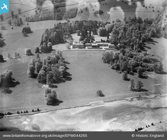
EPW044265 ENGLAND (1934). Shardeloes House and Park, Amersham, 1934. This image has been produced from a damaged negative.
© Hawlfraint cyfranwyr OpenStreetMap a thrwyddedwyd gan yr OpenStreetMap Foundation. 2026. Trwyddedir y gartograffeg fel CC BY-SA.
Delweddau cyfagos (16)
EPW044265

EPW044886

EPW017833

EPW021357

EPW021355

EPW044259

EPW044261

EPW021356

EPW044258

EPW044262

EPW044263

EPW044260

EPW021358

EPW044264

EPW044894

EPW044257

Manylion
| Pennawd | [EPW044265] Shardeloes House and Park, Amersham, 1934. This image has been produced from a damaged negative. |
| Cyfeirnod | EPW044265 |
| Dyddiad | May-1934 |
| Dolen | |
| Enw lle | AMERSHAM |
| Plwyf | AMERSHAM |
| Ardal | |
| Gwlad | ENGLAND |
| Dwyreiniad / Gogleddiad | 493938, 197916 |
| Hydred / Lledred | -0.64140496204649, 51.671688985358 |
| Cyfeirnod Grid Cenedlaethol | SU939979 |
Pinnau

totoro |
Sunday 15th of December 2013 10:38:49 PM | |
|
totoro |
Sunday 15th of December 2013 10:38:32 PM | |
|
totoro |
Sunday 15th of December 2013 10:37:52 PM | |
|
totoro |
Sunday 15th of December 2013 10:37:36 PM | |
|
totoro |
Sunday 15th of December 2013 10:37:20 PM | |
|
totoro |
Sunday 15th of December 2013 10:36:10 PM |