
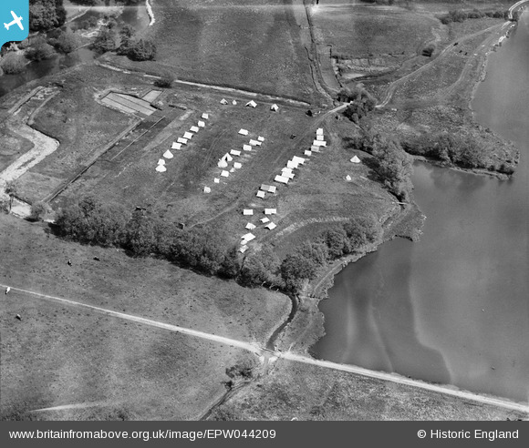
EPW044209 ENGLAND (1934). Campsite adjacent to Bury Lake, Rickmansworth, 1934
© Hawlfraint cyfranwyr OpenStreetMap a thrwyddedwyd gan yr OpenStreetMap Foundation. 2026. Trwyddedir y gartograffeg fel CC BY-SA.
Delweddau cyfagos (4)
EPW044209

EPW044210

EAW026494

EAW026493

Manylion
| Pennawd | [EPW044209] Campsite adjacent to Bury Lake, Rickmansworth, 1934 |
| Cyfeirnod | EPW044209 |
| Dyddiad | May-1934 |
| Dolen | |
| Enw lle | RICKMANSWORTH |
| Plwyf | |
| Ardal | |
| Gwlad | ENGLAND |
| Dwyreiniad / Gogleddiad | 505074, 193881 |
| Hydred / Lledred | -0.4816190111214, 51.633445093509 |
| Cyfeirnod Grid Cenedlaethol | TQ051939 |
Pinnau

This is six |
Monday 7th of April 2014 02:37:08 PM |