
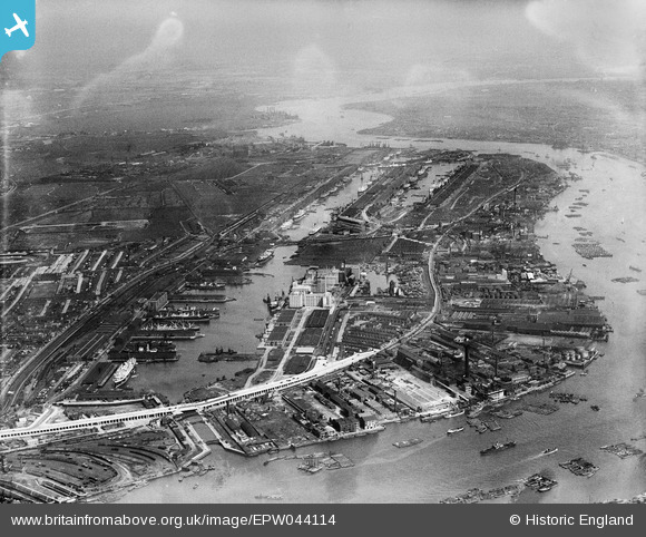
EPW044114 ENGLAND (1934). The Royal Group of Docks and the River Thames, East Ham, from the west, 1934
© Hawlfraint cyfranwyr OpenStreetMap a thrwyddedwyd gan yr OpenStreetMap Foundation. 2026. Trwyddedir y gartograffeg fel CC BY-SA.
Delweddau cyfagos (10)
EPW044114

EAW008817

EPW046155

EAW000053

EAW008823

EAW008824

EPW046150

EPW044120

EPW059927

EAW000038

Manylion
| Pennawd | [EPW044114] The Royal Group of Docks and the River Thames, East Ham, from the west, 1934 |
| Cyfeirnod | EPW044114 |
| Dyddiad | May-1934 |
| Dolen | |
| Enw lle | EAST HAM |
| Plwyf | |
| Ardal | |
| Gwlad | ENGLAND |
| Dwyreiniad / Gogleddiad | 540347, 180356 |
| Hydred / Lledred | 0.022394255557777, 51.504204339317 |
| Cyfeirnod Grid Cenedlaethol | TQ403804 |
Pinnau
Byddwch y cyntaf i ychwanegu sylw at y ddelwedd hon!