
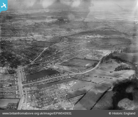
EPW043931 ENGLAND (1934). Housing at Greenwood Road, Ashworth Close and Oakdale Road, Nottingham, from the south-west, 1934
© Hawlfraint cyfranwyr OpenStreetMap a thrwyddedwyd gan yr OpenStreetMap Foundation. 2026. Trwyddedir y gartograffeg fel CC BY-SA.
Delweddau cyfagos (7)
EPW043931

EPW043619

EPW043618

EPW043622

EPW043623

EPW043933

EPW043935

Manylion
| Pennawd | [EPW043931] Housing at Greenwood Road, Ashworth Close and Oakdale Road, Nottingham, from the south-west, 1934 |
| Cyfeirnod | EPW043931 |
| Dyddiad | April-1934 |
| Dolen | |
| Enw lle | NOTTINGHAM |
| Plwyf | |
| Ardal | |
| Gwlad | ENGLAND |
| Dwyreiniad / Gogleddiad | 459582, 340180 |
| Hydred / Lledred | -1.1129981891292, 52.955368211403 |
| Cyfeirnod Grid Cenedlaethol | SK596402 |
Pinnau

Granthampie |
Saturday 26th of April 2014 09:05:42 AM | |
|
totoro |
Sunday 23rd of March 2014 10:09:33 AM | |
|
totoro |
Sunday 23rd of March 2014 10:02:01 AM | |
|
totoro |
Sunday 23rd of March 2014 10:00:56 AM | |
|
totoro |
Sunday 23rd of March 2014 09:59:50 AM | |
|
totoro |
Sunday 23rd of March 2014 09:59:02 AM | |
|
totoro |
Sunday 23rd of March 2014 09:58:21 AM | |
|
totoro |
Sunday 23rd of March 2014 09:57:33 AM | |
|
totoro |
Sunday 23rd of March 2014 09:56:53 AM | |
|
totoro |
Sunday 23rd of March 2014 09:55:53 AM | |
|
totoro |
Sunday 23rd of March 2014 09:54:59 AM | |
|
totoro |
Sunday 23rd of March 2014 09:54:03 AM |