
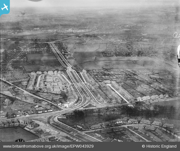
EPW043929 ENGLAND (1934). Housing at Southwold Drive, Marchwood Close and the Western Boulevard, Radford, from the south-west, 1934
© Hawlfraint cyfranwyr OpenStreetMap a thrwyddedwyd gan yr OpenStreetMap Foundation. 2026. Trwyddedir y gartograffeg fel CC BY-SA.
Delweddau cyfagos (12)
EPW043929

EPW046105

EPW046103

EPW046106

EPW046104

EPW043927

EPW043928

EPW043615

EPW046101

EPW043926

EPW043614

EPW043930

Manylion
| Pennawd | [EPW043929] Housing at Southwold Drive, Marchwood Close and the Western Boulevard, Radford, from the south-west, 1934 |
| Cyfeirnod | EPW043929 |
| Dyddiad | April-1934 |
| Dolen | |
| Enw lle | RADFORD |
| Plwyf | |
| Ardal | |
| Gwlad | ENGLAND |
| Dwyreiniad / Gogleddiad | 454432, 340089 |
| Hydred / Lledred | -1.1896731578035, 52.955097542568 |
| Cyfeirnod Grid Cenedlaethol | SK544401 |
Pinnau

mrg |
Tuesday 21st of October 2025 05:10:44 AM | |
|
mrg |
Tuesday 21st of October 2025 05:10:09 AM | |
|
mrg |
Tuesday 21st of October 2025 05:09:33 AM | |
|
mrg |
Tuesday 21st of October 2025 05:05:22 AM | |
|
mrg |
Tuesday 21st of October 2025 05:04:11 AM | |
|
mrg |
Tuesday 21st of October 2025 05:02:20 AM |