
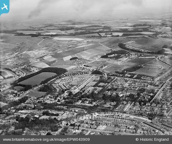
EPW043909 ENGLAND (1934). Withdean Park, housing development around Withdean Crescent and environs, Withdean, from the south-west, 1934
© Hawlfraint cyfranwyr OpenStreetMap a thrwyddedwyd gan yr OpenStreetMap Foundation. 2026. Trwyddedir y gartograffeg fel CC BY-SA.
Delweddau cyfagos (2)
EPW043909

EPW043907

Manylion
| Pennawd | [EPW043909] Withdean Park, housing development around Withdean Crescent and environs, Withdean, from the south-west, 1934 |
| Cyfeirnod | EPW043909 |
| Dyddiad | March-1934 |
| Dolen | |
| Enw lle | WITHDEAN |
| Plwyf | |
| Ardal | |
| Gwlad | ENGLAND |
| Dwyreiniad / Gogleddiad | 530320, 107071 |
| Hydred / Lledred | -0.14858861900648, 50.847902989683 |
| Cyfeirnod Grid Cenedlaethol | TQ303071 |
Pinnau
Byddwch y cyntaf i ychwanegu sylw at y ddelwedd hon!