
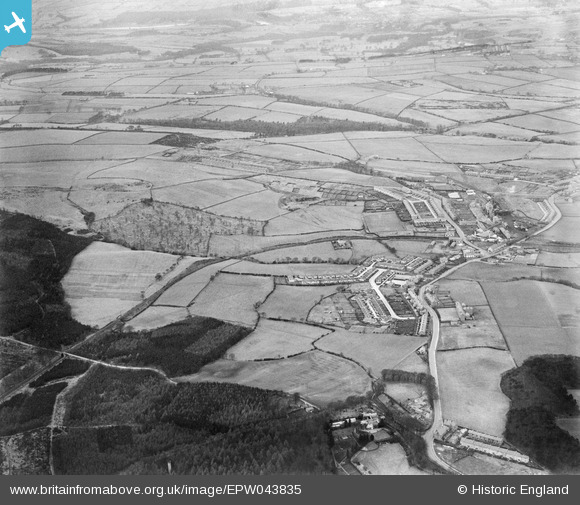
EPW043835 ENGLAND (1934). High Spen village and the Garesfield and Chopwell Railway, High Spen, from the south-east, 1934
© Hawlfraint cyfranwyr OpenStreetMap a thrwyddedwyd gan yr OpenStreetMap Foundation. 2026. Trwyddedir y gartograffeg fel CC BY-SA.
Delweddau cyfagos (2)
EPW043835

EPW043816

Manylion
| Pennawd | [EPW043835] High Spen village and the Garesfield and Chopwell Railway, High Spen, from the south-east, 1934 |
| Cyfeirnod | EPW043835 |
| Dyddiad | February-1934 |
| Dolen | |
| Enw lle | HIGH SPEN |
| Plwyf | |
| Ardal | |
| Gwlad | ENGLAND |
| Dwyreiniad / Gogleddiad | 413801, 559188 |
| Hydred / Lledred | -1.7846225505629, 54.927105633413 |
| Cyfeirnod Grid Cenedlaethol | NZ138592 |
Pinnau

Tired Hiker |
Friday 5th of April 2024 03:28:05 PM |