
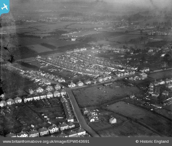
EPW043691 ENGLAND (1934). Meadow Waye and environs, Heston, from the south-west, 1934
© Hawlfraint cyfranwyr OpenStreetMap a thrwyddedwyd gan yr OpenStreetMap Foundation. 2026. Trwyddedir y gartograffeg fel CC BY-SA.
Delweddau cyfagos (14)
EPW043691

EPW043690

EPW043704

EPW043705

EPW043708

EPW043687

EPW043706

EPW057931

EPW043710

EPW043693

EPW043707

EPW043692

EPW043688

EPW035081

Manylion
| Pennawd | [EPW043691] Meadow Waye and environs, Heston, from the south-west, 1934 |
| Cyfeirnod | EPW043691 |
| Dyddiad | January-1934 |
| Dolen | |
| Enw lle | HESTON |
| Plwyf | |
| Ardal | |
| Gwlad | ENGLAND |
| Dwyreiniad / Gogleddiad | 512115, 177228 |
| Hydred / Lledred | -0.38522583718338, 51.482394624607 |
| Cyfeirnod Grid Cenedlaethol | TQ121772 |
Pinnau

strtncll |
Sunday 7th of May 2023 12:42:12 PM | |
|
Isleworth1961 |
Monday 10th of June 2013 06:51:31 PM |