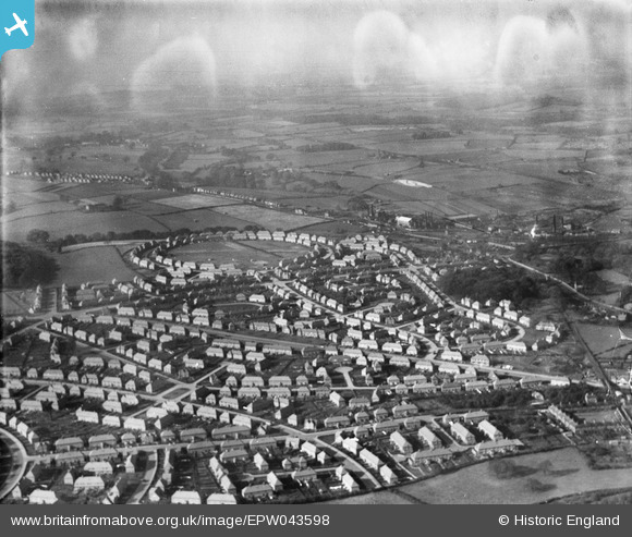
EPW043598 ENGLAND (1933). Housing at Amesbury Circus and Broxtowe Lane, Nottingham, from the south-east, 1933
© Hawlfraint cyfranwyr OpenStreetMap a thrwyddedwyd gan yr OpenStreetMap Foundation. 2026. Trwyddedir y gartograffeg fel CC BY-SA.
Manylion
| Pennawd | [EPW043598] Housing at Amesbury Circus and Broxtowe Lane, Nottingham, from the south-east, 1933 |
| Cyfeirnod | EPW043598 |
| Dyddiad | October-1933 |
| Dolen | |
| Enw lle | NOTTINGHAM |
| Plwyf | |
| Ardal | |
| Gwlad | ENGLAND |
| Dwyreiniad / Gogleddiad | 453740, 342881 |
| Hydred / Lledred | -1.199510273408, 52.980265695176 |
| Cyfeirnod Grid Cenedlaethol | SK537429 |
Pinnau

Dave |
Monday 2nd of February 2015 08:27:23 PM |


![[EPW043598] Housing at Amesbury Circus and Broxtowe Lane, Nottingham, from the south-east, 1933](http://britainfromabove.org.uk/sites/all/libraries/aerofilms-images/public/100x100/EPW/043/EPW043598.jpg)
![[EPW043941] Housing at Amesbury Circus, Dulverton Vale and Broxtowe Lane, Cinderhill, from the south-east, 1934](http://britainfromabove.org.uk/sites/all/libraries/aerofilms-images/public/100x100/EPW/043/EPW043941.jpg)
![[EPW043942] Housing at Amesbury Circus, Dulverton Vale and Broxtowe Lane, Cinderhill, from the east, 1934](http://britainfromabove.org.uk/sites/all/libraries/aerofilms-images/public/100x100/EPW/043/EPW043942.jpg)