
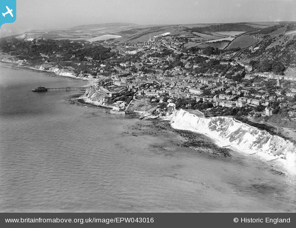
EPW043016 ENGLAND (1933). The coastlline and the town, Ventnor, from the south-east, 1933
© Hawlfraint cyfranwyr OpenStreetMap a thrwyddedwyd gan yr OpenStreetMap Foundation. 2026. Trwyddedir y gartograffeg fel CC BY-SA.
Delweddau cyfagos (3)
EPW043016

EPW000500

EAW038590

Manylion
| Pennawd | [EPW043016] The coastlline and the town, Ventnor, from the south-east, 1933 |
| Cyfeirnod | EPW043016 |
| Dyddiad | August-1933 |
| Dolen | |
| Enw lle | VENTNOR |
| Plwyf | VENTNOR |
| Ardal | |
| Gwlad | ENGLAND |
| Dwyreiniad / Gogleddiad | 457176, 77405 |
| Hydred / Lledred | -1.1921383553684, 50.592981545912 |
| Cyfeirnod Grid Cenedlaethol | SZ572774 |
Pinnau

flubber |
Monday 1st of September 2014 01:38:18 PM |