
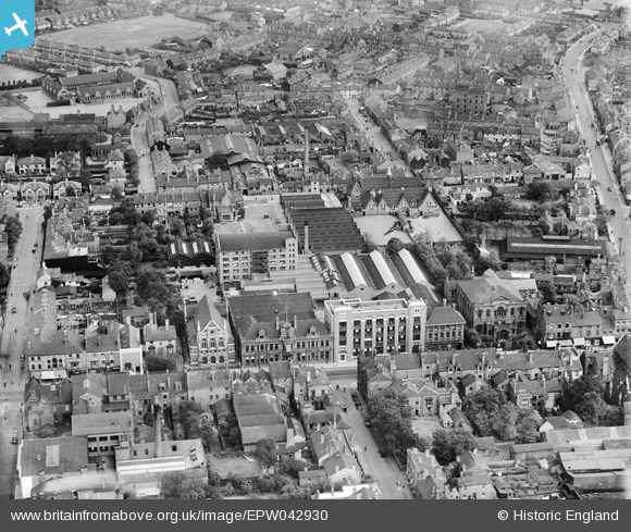
EPW042930 ENGLAND (1933). Kenrick and Jefferson Printing Works and environs, West Bromwich, 1933
© Hawlfraint cyfranwyr OpenStreetMap a thrwyddedwyd gan yr OpenStreetMap Foundation. 2026. Trwyddedir y gartograffeg fel CC BY-SA.
Delweddau cyfagos (14)
EPW042930

EPW042922

EPW042924

EPW042926

EPW042921

EPW042925

EPW042927

EPW042923

EPW042929

EPW042928

EPR000565

EPW021862

EPW057564

EPW057563

Manylion
| Pennawd | [EPW042930] Kenrick and Jefferson Printing Works and environs, West Bromwich, 1933 |
| Cyfeirnod | EPW042930 |
| Dyddiad | August-1933 |
| Dolen | |
| Enw lle | WEST BROMWICH |
| Plwyf | |
| Ardal | |
| Gwlad | ENGLAND |
| Dwyreiniad / Gogleddiad | 400472, 291366 |
| Hydred / Lledred | -1.9930430708984, 52.519809756542 |
| Cyfeirnod Grid Cenedlaethol | SP005914 |
