
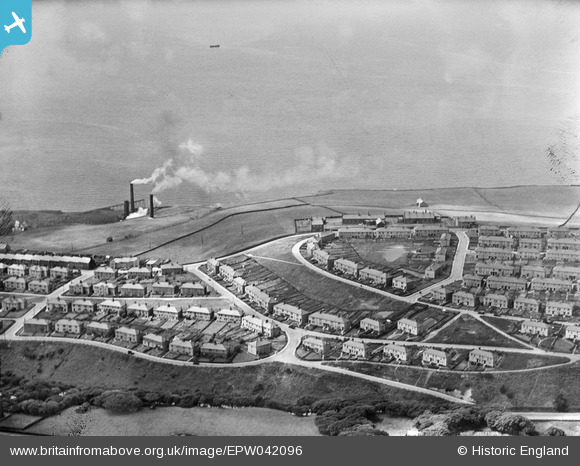
EPW042096 ENGLAND (1933). Bransty housing estate, Whitehaven, 1933
© Hawlfraint cyfranwyr OpenStreetMap a thrwyddedwyd gan yr OpenStreetMap Foundation. 2026. Trwyddedir y gartograffeg fel CC BY-SA.
Manylion
| Pennawd | [EPW042096] Bransty housing estate, Whitehaven, 1933 |
| Cyfeirnod | EPW042096 |
| Dyddiad | June-1933 |
| Dolen | |
| Enw lle | WHITEHAVEN |
| Plwyf | |
| Ardal | |
| Gwlad | ENGLAND |
| Dwyreiniad / Gogleddiad | 297597, 519146 |
| Hydred / Lledred | -3.5836570211711, 54.557051394931 |
| Cyfeirnod Grid Cenedlaethol | NX976191 |
Pinnau

jr19700 |
Saturday 14th of September 2019 10:31:09 AM |
Cyfraniadau Grŵp
Tobacco Pipes on Bransty |
MotoFreako64 |
Friday 14th of June 2013 08:48:58 PM |