
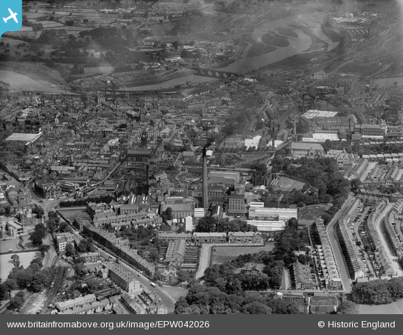
EPW042026 ENGLAND (1933). The city centre, Lancaster, from the south, 1933
© Hawlfraint cyfranwyr OpenStreetMap a thrwyddedwyd gan yr OpenStreetMap Foundation. 2026. Trwyddedir y gartograffeg fel CC BY-SA.
Delweddau cyfagos (7)
EPW042026

EPW002083

EPW002090

EPW026406

EPW029182

EPW042037

EPW002084

Manylion
| Pennawd | [EPW042026] The city centre, Lancaster, from the south, 1933 |
| Cyfeirnod | EPW042026 |
| Dyddiad | June-1933 |
| Dolen | |
| Enw lle | LANCASTER |
| Plwyf | |
| Ardal | |
| Gwlad | ENGLAND |
| Dwyreiniad / Gogleddiad | 347979, 461217 |
| Hydred / Lledred | -2.7945381369468, 54.044110324209 |
| Cyfeirnod Grid Cenedlaethol | SD480612 |
Pinnau

sirdouglas |
Sunday 23rd of August 2015 02:22:58 PM | |
|
sirdouglas |
Sunday 23rd of August 2015 02:22:22 PM | |

Class31 |
Tuesday 11th of August 2015 10:31:12 AM | |
|
Class31 |
Tuesday 11th of August 2015 10:29:01 AM | |
|
Class31 |
Tuesday 11th of August 2015 10:28:17 AM | |
|
Class31 |
Tuesday 11th of August 2015 10:26:14 AM |


