
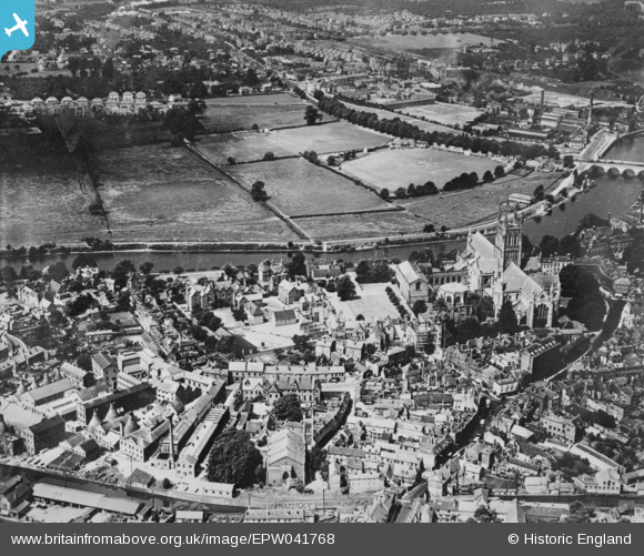
EPW041768 ENGLAND (1933). King's School, Christ and St Mary's Cathedral and environs, Worcester, 1933. This image has been produced from a copy-negative.
© Hawlfraint cyfranwyr OpenStreetMap a thrwyddedwyd gan yr OpenStreetMap Foundation. 2026. Trwyddedir y gartograffeg fel CC BY-SA.
Delweddau cyfagos (21)
EPW041768

EPW034600

EPW041738

EPW041739

EPW000398

EPW000208

EAW046116

EPW005411

EPW005408

EPW005409

EPW001305

EPW000401

EPW000205

EAW046115

EPW001335

EPW035910

EPW048089

EPW000202

EAW003990

EAW023847

EPW048086

Manylion
| Pennawd | [EPW041768] King's School, Christ and St Mary's Cathedral and environs, Worcester, 1933. This image has been produced from a copy-negative. |
| Cyfeirnod | EPW041768 |
| Dyddiad | June-1933 |
| Dolen | |
| Enw lle | WORCESTER |
| Plwyf | |
| Ardal | |
| Gwlad | ENGLAND |
| Dwyreiniad / Gogleddiad | 384900, 254409 |
| Hydred / Lledred | -2.2208990173928, 52.187315403165 |
| Cyfeirnod Grid Cenedlaethol | SO849544 |
Pinnau

peter stuart legat |
Monday 5th of April 2021 05:45:35 PM | |
|
MICK C |
Saturday 28th of October 2017 04:03:45 PM | |
|
MICK C |
Saturday 28th of October 2017 04:02:39 PM |