
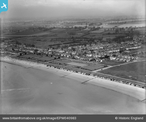
EPW040983 ENGLAND (1933). Housing along the Thorpe Bay Esplanade, Southend-on-Sea, from the south-east, 1933
© Hawlfraint cyfranwyr OpenStreetMap a thrwyddedwyd gan yr OpenStreetMap Foundation. 2026. Trwyddedir y gartograffeg fel CC BY-SA.
Delweddau cyfagos (7)
EPW040983

EPW036745

EPW036744

EPW036746

EPW036721

EPW036699

EPW036698

Manylion
| Pennawd | [EPW040983] Housing along the Thorpe Bay Esplanade, Southend-on-Sea, from the south-east, 1933 |
| Cyfeirnod | EPW040983 |
| Dyddiad | April-1933 |
| Dolen | |
| Enw lle | SOUTHEND-ON-SEA |
| Plwyf | |
| Ardal | |
| Gwlad | ENGLAND |
| Dwyreiniad / Gogleddiad | 591471, 184563 |
| Hydred / Lledred | 0.76057765252458, 51.526986400259 |
| Cyfeirnod Grid Cenedlaethol | TQ915846 |
Pinnau
Byddwch y cyntaf i ychwanegu sylw at y ddelwedd hon!