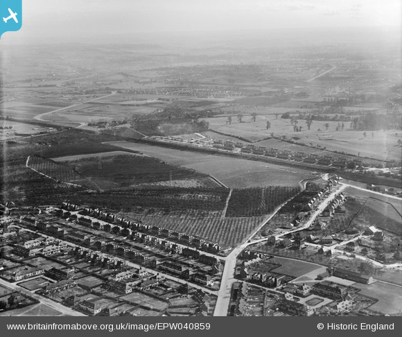
EPW040859 ENGLAND (1933). Barnehurst Golf Course and housing under construction at Barnehurst Avenue and environs, Barnehurst, from the north-west, 1933
    © Hawlfraint cyfranwyr OpenStreetMap a thrwyddedwyd gan yr OpenStreetMap Foundation. 2025. Trwyddedir y gartograffeg fel CC BY-SA.
  
Manylion
| Pennawd | [EPW040859] Barnehurst Golf Course and housing under construction at Barnehurst Avenue and environs, Barnehurst, from the north-west, 1933 | 
| Cyfeirnod | EPW040859 | 
| Dyddiad | March-1933 | 
| Dolen | |
| Enw lle | BARNEHURST | 
| Plwyf | |
| Ardal | |
| Gwlad | ENGLAND | 
| Dwyreiniad / Gogleddiad | 550521, 176623 | 
| Hydred / Lledred | 0.16730043953547, 51.468040899255 | 
| Cyfeirnod Grid Cenedlaethol | TQ505766 | 
Pinnau
Byddwch y cyntaf i ychwanegu sylw at y ddelwedd hon!
 
             
  ![[EPW040859] Barnehurst Golf Course and housing under construction at Barnehurst Avenue and environs, Barnehurst, from the north-west, 1933](http://britainfromabove.org.uk/sites/all/libraries/aerofilms-images/public/100x100/EPW/040/EPW040859.jpg) 
  
                                          ![[EPW040856] Barnehurst Golf Course and housing under construction at Barnehurst Avenue and environs, Barnehurst, from the north-west, 1933](http://britainfromabove.org.uk/sites/all/libraries/aerofilms-images/public/100x100/EPW/040/EPW040856.jpg) 
 ![[EPW040855] Barnehurst Golf Course and housing under construction at Barnehurst Avenue and environs, Barnehurst, from the north-west, 1933](http://britainfromabove.org.uk/sites/all/libraries/aerofilms-images/public/100x100/EPW/040/EPW040855.jpg) 
 ![[EPW044330] Appledore Avenue, Fairford Avenue and environs, Barneshurst, 1934](http://britainfromabove.org.uk/sites/all/libraries/aerofilms-images/public/100x100/EPW/044/EPW044330.jpg)