
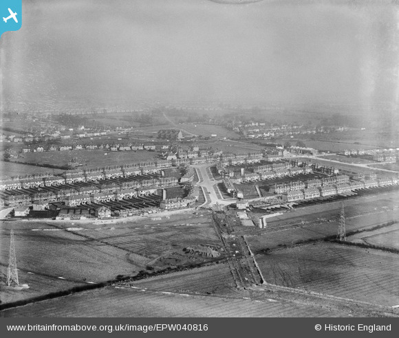
EPW040816 ENGLAND (1933). Housing estate under construction at Kings Road, Rayners Lane, from the south, 1933
© Hawlfraint cyfranwyr OpenStreetMap a thrwyddedwyd gan yr OpenStreetMap Foundation. 2025. Trwyddedir y gartograffeg fel CC BY-SA.
Delweddau cyfagos (7)
EPW040816

EPW040810

EPW040813

EPW046496

EPW046493

EPW040809

EPW040807

Manylion
| Pennawd | [EPW040816] Housing estate under construction at Kings Road, Rayners Lane, from the south, 1933 |
| Cyfeirnod | EPW040816 |
| Dyddiad | February-1933 |
| Dolen | |
| Enw lle | RAYNERS LANE |
| Plwyf | |
| Ardal | |
| Gwlad | ENGLAND |
| Dwyreiniad / Gogleddiad | 512661, 187022 |
| Hydred / Lledred | -0.37423216602589, 51.570322905361 |
| Cyfeirnod Grid Cenedlaethol | TQ127870 |
Pinnau

TinyTim |
Friday 31st of July 2015 04:33:28 PM | |
|
TinyTim |
Friday 31st of July 2015 04:31:56 PM | |
|
TinyTim |
Friday 31st of July 2015 04:30:53 PM | |
|
TinyTim |
Friday 31st of July 2015 04:30:23 PM |