
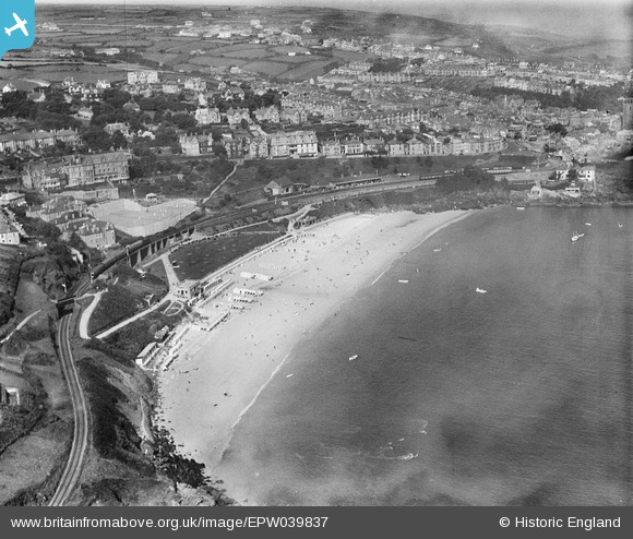
EPW039837 ENGLAND (1932). Porthminster Beach, the St Ives Branch Railway and the town, St Ives, 1932
© Hawlfraint cyfranwyr OpenStreetMap a thrwyddedwyd gan yr OpenStreetMap Foundation. 2026. Trwyddedir y gartograffeg fel CC BY-SA.
Delweddau cyfagos (6)
EPW039837

EAW015139

EPW007152

EPW039836

EPW021749

EPW039832

Manylion
| Pennawd | [EPW039837] Porthminster Beach, the St Ives Branch Railway and the town, St Ives, 1932 |
| Cyfeirnod | EPW039837 |
| Dyddiad | August-1932 |
| Dolen | |
| Enw lle | ST IVES |
| Plwyf | ST. IVES |
| Ardal | |
| Gwlad | ENGLAND |
| Dwyreiniad / Gogleddiad | 152046, 40118 |
| Hydred / Lledred | -5.4755652463182, 50.208413439928 |
| Cyfeirnod Grid Cenedlaethol | SW520401 |
Pinnau
Byddwch y cyntaf i ychwanegu sylw at y ddelwedd hon!