
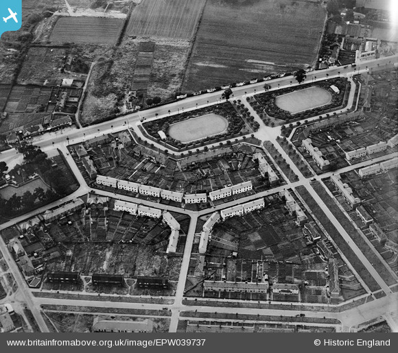
EPW039737 ENGLAND (1932). Losinga Crescent, Bolingbroke Road and Suckling Avenue, Upper Hellesdon, 1932
© Hawlfraint cyfranwyr OpenStreetMap a thrwyddedwyd gan yr OpenStreetMap Foundation. 2026. Trwyddedir y gartograffeg fel CC BY-SA.
Delweddau cyfagos (2)
EPW039737

EPW039741

Manylion
| Pennawd | [EPW039737] Losinga Crescent, Bolingbroke Road and Suckling Avenue, Upper Hellesdon, 1932 |
| Cyfeirnod | EPW039737 |
| Dyddiad | 23-July-1932 |
| Dolen | |
| Enw lle | UPPER HELLESDON |
| Plwyf | |
| Ardal | |
| Gwlad | ENGLAND |
| Dwyreiniad / Gogleddiad | 621749, 311362 |
| Hydred / Lledred | 1.2789013351465, 52.654217048812 |
| Cyfeirnod Grid Cenedlaethol | TG217114 |
Pinnau

Chris Lambert |
Sunday 12th of April 2015 04:57:26 PM |