
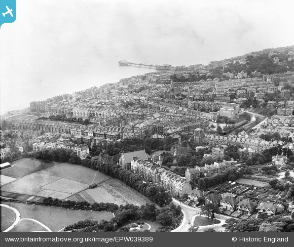
EPW039389 ENGLAND (1932). The town centre with Palace Pier in the distance, Hastings, from the north-east, 1932
© Hawlfraint cyfranwyr OpenStreetMap a thrwyddedwyd gan yr OpenStreetMap Foundation. 2026. Trwyddedir y gartograffeg fel CC BY-SA.
Delweddau cyfagos (3)
EPW039389

EPW026202

EPW000156

Manylion
| Pennawd | [EPW039389] The town centre with Palace Pier in the distance, Hastings, from the north-east, 1932 |
| Cyfeirnod | EPW039389 |
| Dyddiad | August-1932 |
| Dolen | |
| Enw lle | HASTINGS |
| Plwyf | |
| Ardal | |
| Gwlad | ENGLAND |
| Dwyreiniad / Gogleddiad | 580593, 109477 |
| Hydred / Lledred | 0.5661508305428, 50.856011341524 |
| Cyfeirnod Grid Cenedlaethol | TQ806095 |
Pinnau
Byddwch y cyntaf i ychwanegu sylw at y ddelwedd hon!
Cyfraniadau Grŵp
Great to be able to see St Leonards Station When you zoom in. |

dmuston |
Tuesday 12th of November 2013 08:56:22 AM |
This is St Leonards, not Hastings. St Leonards Pier was known as the American Palace Pier from 1909 to 1934 when it was renamed The New Palace Pier http://www.hastingschronicle.net/stLeonardsPier.html |
Rod Smith |
Friday 14th of June 2013 04:59:11 PM |