
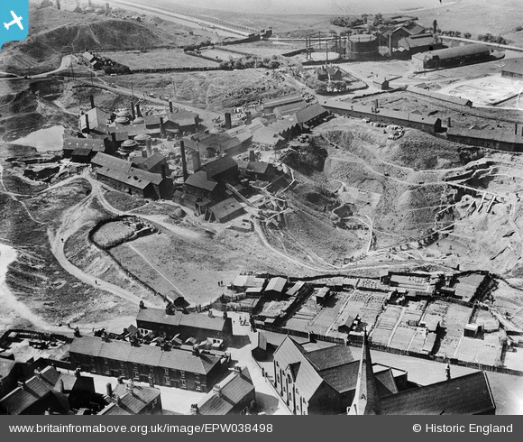
EPW038498 ENGLAND (1932). The Brownhills Tileries and environs, Tunstall, 1932
© Hawlfraint cyfranwyr OpenStreetMap a thrwyddedwyd gan yr OpenStreetMap Foundation. 2026. Trwyddedir y gartograffeg fel CC BY-SA.
Delweddau cyfagos (6)
EPW038498

EPW038499

EPW038502

EPW038497

EPW038500

EPW038501

Manylion
| Pennawd | [EPW038498] The Brownhills Tileries and environs, Tunstall, 1932 |
| Cyfeirnod | EPW038498 |
| Dyddiad | June-1932 |
| Dolen | |
| Enw lle | TUNSTALL |
| Plwyf | |
| Ardal | |
| Gwlad | ENGLAND |
| Dwyreiniad / Gogleddiad | 385709, 350776 |
| Hydred / Lledred | -2.2132332483193, 53.053746935956 |
| Cyfeirnod Grid Cenedlaethol | SJ857508 |
Pinnau
Byddwch y cyntaf i ychwanegu sylw at y ddelwedd hon!