
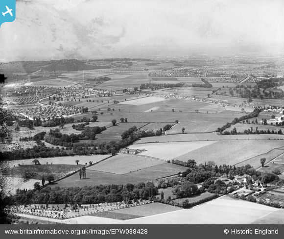
EPW038428 ENGLAND (1932). New housing site near Blackfen and Lamorbey Park Golf Course, Bexley, from the south-east, 1932
© Hawlfraint cyfranwyr OpenStreetMap a thrwyddedwyd gan yr OpenStreetMap Foundation. 2026. Trwyddedir y gartograffeg fel CC BY-SA.
Delweddau cyfagos (6)
EPW038428

EPW038432

EPW044372

EPW044375

EPW044371

EPW038440

Manylion
| Pennawd | [EPW038428] New housing site near Blackfen and Lamorbey Park Golf Course, Bexley, from the south-east, 1932 |
| Cyfeirnod | EPW038428 |
| Dyddiad | 14-June-1932 |
| Dolen | |
| Enw lle | BEXLEY |
| Plwyf | |
| Ardal | |
| Gwlad | ENGLAND |
| Dwyreiniad / Gogleddiad | 547427, 173295 |
| Hydred / Lledred | 0.1213969551377, 51.438948792376 |
| Cyfeirnod Grid Cenedlaethol | TQ474733 |
Pinnau

Stephen Challis |
Friday 13th of February 2015 09:44:39 PM | |
|
Stephen Challis |
Friday 13th of February 2015 09:44:11 PM | |
|
Stephen Challis |
Friday 13th of February 2015 09:43:51 PM | |
|
Stephen Challis |
Friday 13th of February 2015 09:43:36 PM | |
|
Stephen Challis |
Friday 13th of February 2015 09:43:11 PM |