
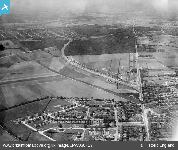
EPW038419 ENGLAND (1932). New housing site alongside Welling Way, Oxleas Wood and Bellegrove Road, Welling, from the east, 1932
© Hawlfraint cyfranwyr OpenStreetMap a thrwyddedwyd gan yr OpenStreetMap Foundation. 2026. Trwyddedir y gartograffeg fel CC BY-SA.
Delweddau cyfagos (7)
EPW038419

EPW038418

EPW038209

EPW038190

EPW038421

EPW038186

EPW038208

Manylion
| Pennawd | [EPW038419] New housing site alongside Welling Way, Oxleas Wood and Bellegrove Road, Welling, from the east, 1932 |
| Cyfeirnod | EPW038419 |
| Dyddiad | 14-June-1932 |
| Dolen | |
| Enw lle | WELLING |
| Plwyf | |
| Ardal | |
| Gwlad | ENGLAND |
| Dwyreiniad / Gogleddiad | 545777, 175752 |
| Hydred / Lledred | 0.098684046543825, 51.461455824451 |
| Cyfeirnod Grid Cenedlaethol | TQ458758 |
Pinnau

MR G A J REID |
Tuesday 1st of December 2020 12:13:53 PM |