
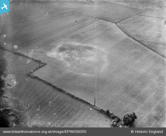
EPW038355 ENGLAND (1932). A cropmark near Poplar Gate, Leonard Stanley, 1932. This image has been produced from a damaged negative.
© Hawlfraint cyfranwyr OpenStreetMap a thrwyddedwyd gan yr OpenStreetMap Foundation. 2026. Trwyddedir y gartograffeg fel CC BY-SA.
Delweddau cyfagos (2)
EPW038355

EPW038356

Manylion
| Pennawd | [EPW038355] A cropmark near Poplar Gate, Leonard Stanley, 1932. This image has been produced from a damaged negative. |
| Cyfeirnod | EPW038355 |
| Dyddiad | June-1932 |
| Dolen | |
| Enw lle | LEONARD STANLEY |
| Plwyf | LEONARD STANLEY |
| Ardal | |
| Gwlad | ENGLAND |
| Dwyreiniad / Gogleddiad | 379511, 204011 |
| Hydred / Lledred | -2.2967269130784, 51.733978844159 |
| Cyfeirnod Grid Cenedlaethol | SO795040 |
Pinnau
Cyfraniadau Grŵp
View looking south east. |

Class31 |
Sunday 27th of October 2013 07:43:41 PM |
Same features shown as on EPW038356. I wonder if this is somewhere between Gloucester (EPW038354 taken there) and Bath (EPW038357 taken there). |

Rebecca |
Friday 11th of January 2013 03:46:01 PM |
Archaeological crop or soil mark |
Rebecca |
Wednesday 9th of January 2013 05:20:36 PM |