
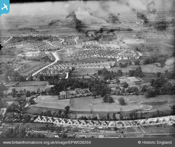
EPW038260 ENGLAND (1932). New housing around Marlborough Park and the Golf Course at Lamorbey Park, Sidcup, from the south-east, 1932
© Hawlfraint cyfranwyr OpenStreetMap a thrwyddedwyd gan yr OpenStreetMap Foundation. 2026. Trwyddedir y gartograffeg fel CC BY-SA.
Delweddau cyfagos (7)
EPW038260

EPW044382

EPW038222

EPW038256

EPW038221

EPW038215

EPW038217

Manylion
| Pennawd | [EPW038260] New housing around Marlborough Park and the Golf Course at Lamorbey Park, Sidcup, from the south-east, 1932 |
| Cyfeirnod | EPW038260 |
| Dyddiad | June-1932 |
| Dolen | |
| Enw lle | SIDCUP |
| Plwyf | |
| Ardal | |
| Gwlad | ENGLAND |
| Dwyreiniad / Gogleddiad | 546522, 172908 |
| Hydred / Lledred | 0.10822381104878, 51.435705856006 |
| Cyfeirnod Grid Cenedlaethol | TQ465729 |
Pinnau
Byddwch y cyntaf i ychwanegu sylw at y ddelwedd hon!