
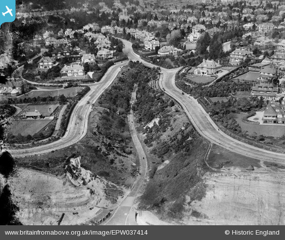
EPW037414 ENGLAND (1932). Housing surrounding West Overcliff Drive and the Middle Chine, Bournemouth, 1932
© Hawlfraint cyfranwyr OpenStreetMap a thrwyddedwyd gan yr OpenStreetMap Foundation. 2026. Trwyddedir y gartograffeg fel CC BY-SA.
Delweddau cyfagos (7)
EPW037414

EPW018166

EPR000667

EPW013555

EAW049055

EPW013554

EPW000265

Manylion
| Pennawd | [EPW037414] Housing surrounding West Overcliff Drive and the Middle Chine, Bournemouth, 1932 |
| Cyfeirnod | EPW037414 |
| Dyddiad | April-1932 |
| Dolen | |
| Enw lle | BOURNEMOUTH |
| Plwyf | |
| Ardal | |
| Gwlad | ENGLAND |
| Dwyreiniad / Gogleddiad | 407600, 90444 |
| Hydred / Lledred | -1.8923433805639, 50.713003348041 |
| Cyfeirnod Grid Cenedlaethol | SZ076904 |
Pinnau

Veejay |
Monday 20th of January 2025 05:18:14 PM | |
|
Veejay |
Monday 20th of January 2025 05:16:32 PM | |
|
Veejay |
Monday 20th of January 2025 05:06:47 PM | |
|
Veejay |
Monday 20th of January 2025 04:35:48 PM | |
|
Gary |
Sunday 7th of November 2021 08:05:49 AM | |
 |

Class31 |
Sunday 26th of January 2014 10:44:48 AM |
Cyfraniadau Grŵp
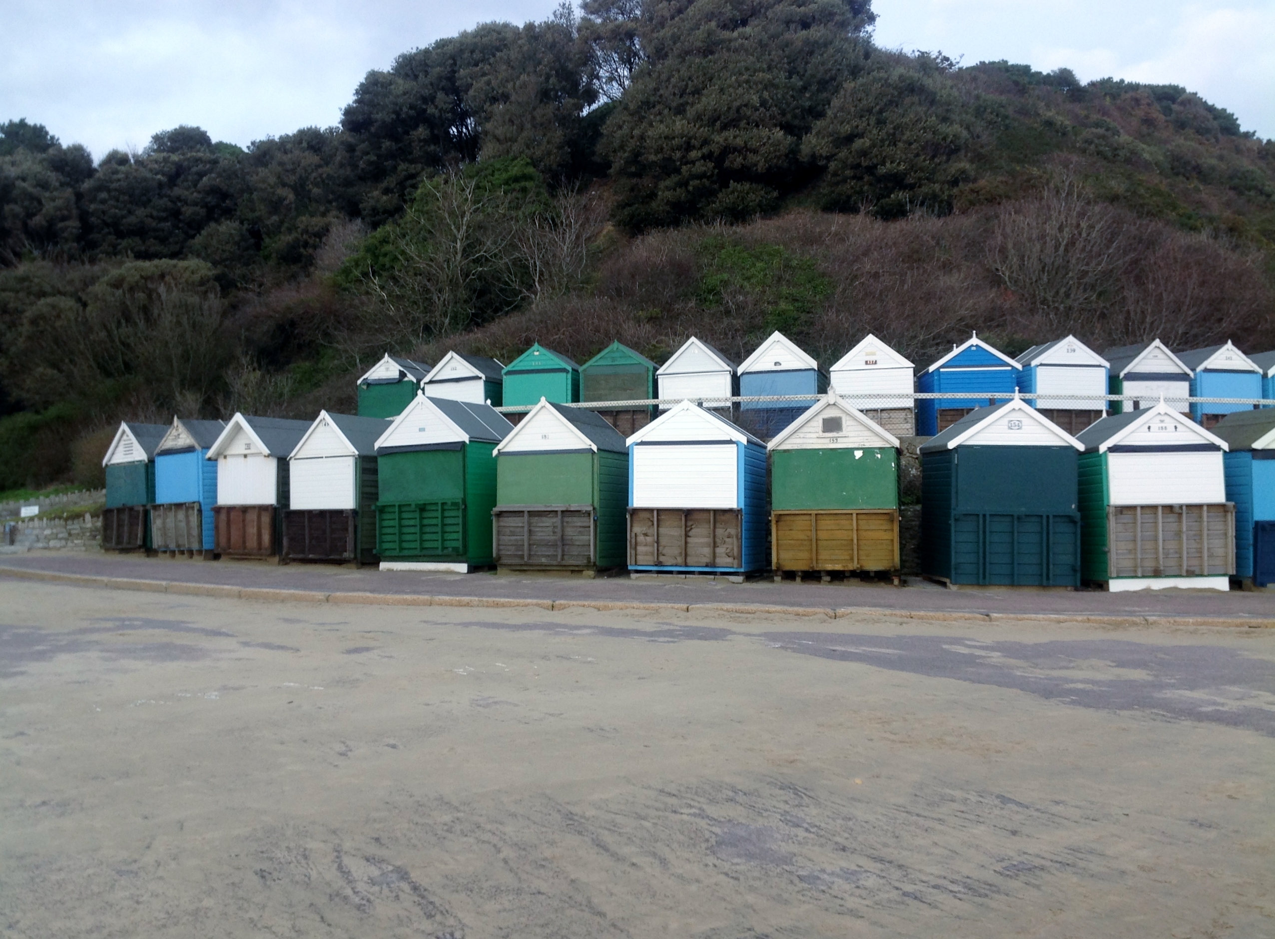
Beach huts at Middle Chine 25/01/2014 |
Class31 |
Sunday 26th of January 2014 10:47:24 AM |