
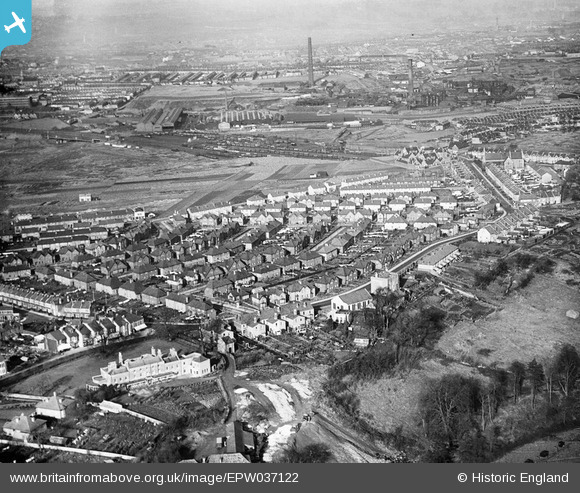
EPW037122 ENGLAND (1931). Housing surrounding Wick Road and Sutton Avenue, Brislington, from the south-east, 1931
© Hawlfraint cyfranwyr OpenStreetMap a thrwyddedwyd gan yr OpenStreetMap Foundation. 2026. Trwyddedir y gartograffeg fel CC BY-SA.
Delweddau cyfagos (12)
EPW037122

EPW037116

EPW037119

EPW037123

EPW037115

EPW037120

EPW037114

EPW037118

EPW037117

EPW037124

EPW037125

EPW037121

Manylion
| Pennawd | [EPW037122] Housing surrounding Wick Road and Sutton Avenue, Brislington, from the south-east, 1931 |
| Cyfeirnod | EPW037122 |
| Dyddiad | October-1931 |
| Dolen | |
| Enw lle | BRISLINGTON |
| Plwyf | |
| Ardal | |
| Gwlad | ENGLAND |
| Dwyreiniad / Gogleddiad | 361901, 171667 |
| Hydred / Lledred | -2.5482377944706, 51.442222398593 |
| Cyfeirnod Grid Cenedlaethol | ST619717 |
Pinnau

kellysheppard510@ymail.com |
Tuesday 17th of January 2017 02:24:20 PM | |

Class31 |
Sunday 3rd of February 2013 09:55:37 PM | |
|
Class31 |
Sunday 3rd of February 2013 09:08:09 PM | |
|
Class31 |
Sunday 3rd of February 2013 08:53:03 PM | |
|
Class31 |
Sunday 3rd of February 2013 08:47:51 PM | |
|
Class31 |
Sunday 3rd of February 2013 08:35:54 PM | |
|
Class31 |
Sunday 3rd of February 2013 08:33:37 PM | |
|
Class31 |
Sunday 3rd of February 2013 08:32:07 PM | |
|
Class31 |
Sunday 3rd of February 2013 08:30:53 PM |