
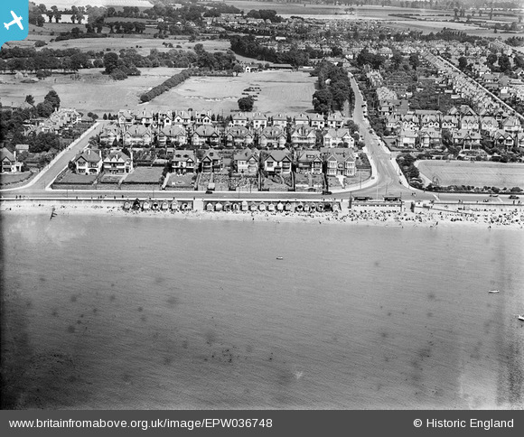
EPW036748 ENGLAND (1931). Thorpe Bay Esplanade, housing surrounding Gloucester Terrace and beach huts along the seafront, Thorpe Bay, 1931
© Hawlfraint cyfranwyr OpenStreetMap a thrwyddedwyd gan yr OpenStreetMap Foundation. 2026. Trwyddedir y gartograffeg fel CC BY-SA.
Delweddau cyfagos (8)
EPW036748

EPW024875

EPW040982

EPW036747

EPW036749

EPW036702

EPW036698

EPW036721

Manylion
| Pennawd | [EPW036748] Thorpe Bay Esplanade, housing surrounding Gloucester Terrace and beach huts along the seafront, Thorpe Bay, 1931 |
| Cyfeirnod | EPW036748 |
| Dyddiad | September-1931 |
| Dolen | |
| Enw lle | THORPE BAY |
| Plwyf | |
| Ardal | |
| Gwlad | ENGLAND |
| Dwyreiniad / Gogleddiad | 591019, 184746 |
| Hydred / Lledred | 0.75416819511293, 51.528783199943 |
| Cyfeirnod Grid Cenedlaethol | TQ910847 |
Pinnau

Floss63 |
Tuesday 19th of May 2026 07:32:02 PM | |
|
Floss63 |
Tuesday 19th of May 2026 07:31:23 PM | |
|
Floss63 |
Tuesday 19th of March 2024 10:47:29 PM | |
|
Floss63 |
Tuesday 19th of March 2024 10:43:34 PM | |
|
John |
Sunday 18th of August 2013 09:24:54 AM |