
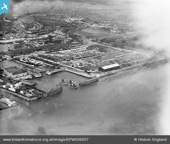
EPW036557 ENGLAND (1931). Outer Basin and No. 1 Timber Pond, Kingston upon Hull, 1931. This image has been affected by flare.
© Hawlfraint cyfranwyr OpenStreetMap a thrwyddedwyd gan yr OpenStreetMap Foundation. 2026. Trwyddedir y gartograffeg fel CC BY-SA.
Delweddau cyfagos (3)
EPW036557

EAW046143

EPW010811

Manylion
| Pennawd | [EPW036557] Outer Basin and No. 1 Timber Pond, Kingston upon Hull, 1931. This image has been affected by flare. |
| Cyfeirnod | EPW036557 |
| Dyddiad | August-1931 |
| Dolen | |
| Enw lle | KINGSTON UPON HULL |
| Plwyf | |
| Ardal | |
| Gwlad | ENGLAND |
| Dwyreiniad / Gogleddiad | 511082, 428512 |
| Hydred / Lledred | -0.3155784575097, 53.740917333675 |
| Cyfeirnod Grid Cenedlaethol | TA111285 |
Pinnau
Byddwch y cyntaf i ychwanegu sylw at y ddelwedd hon!