
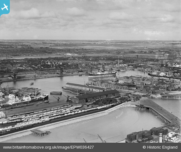
EPW036427 ENGLAND (1931). Alexandra Dock and environs, Kingston upon Hull, from the south-west, 1931
© Hawlfraint cyfranwyr OpenStreetMap a thrwyddedwyd gan yr OpenStreetMap Foundation. 2026. Trwyddedir y gartograffeg fel CC BY-SA.
Delweddau cyfagos (13)
EPW036427

EAW046142

EAW324975

EPW010818

EPW036392

EPW036555

EPW036527

EPW036554

EAW004505

EAW004507

EPW010808

EPW036379

EPW036406

Manylion
| Pennawd | [EPW036427] Alexandra Dock and environs, Kingston upon Hull, from the south-west, 1931 |
| Cyfeirnod | EPW036427 |
| Dyddiad | August-1931 |
| Dolen | |
| Enw lle | KINGSTON UPON HULL |
| Plwyf | |
| Ardal | |
| Gwlad | ENGLAND |
| Dwyreiniad / Gogleddiad | 512286, 428743 |
| Hydred / Lledred | -0.29724618234853, 53.74273498227 |
| Cyfeirnod Grid Cenedlaethol | TA123287 |
Pinnau

John Wass |
Saturday 1st of August 2015 04:35:47 PM |