
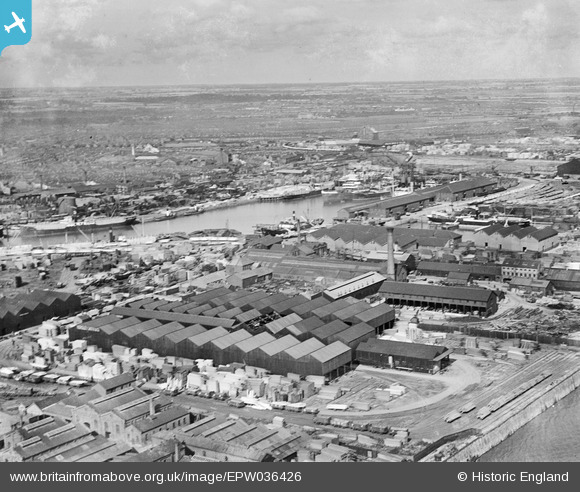
EPW036426 ENGLAND (1931). The London and North Eastern Railway Dock Yard, Victoria Dock and environs, Kingston upon Hull, from the south-west, 1931
© Hawlfraint cyfranwyr OpenStreetMap a thrwyddedwyd gan yr OpenStreetMap Foundation. 2026. Trwyddedir y gartograffeg fel CC BY-SA.
Delweddau cyfagos (9)
EPW036426

EPW062612

EPW062615

EPW062611

EPW036437

EPW062614

EPW062613

EPW012702

EPW036528

Manylion
| Pennawd | [EPW036426] The London and North Eastern Railway Dock Yard, Victoria Dock and environs, Kingston upon Hull, from the south-west, 1931 |
| Cyfeirnod | EPW036426 |
| Dyddiad | August-1931 |
| Dolen | |
| Enw lle | KINGSTON UPON HULL |
| Plwyf | |
| Ardal | |
| Gwlad | ENGLAND |
| Dwyreiniad / Gogleddiad | 510682, 428424 |
| Hydred / Lledred | -0.32167260765297, 53.740211704078 |
| Cyfeirnod Grid Cenedlaethol | TA107284 |
Pinnau
Byddwch y cyntaf i ychwanegu sylw at y ddelwedd hon!