
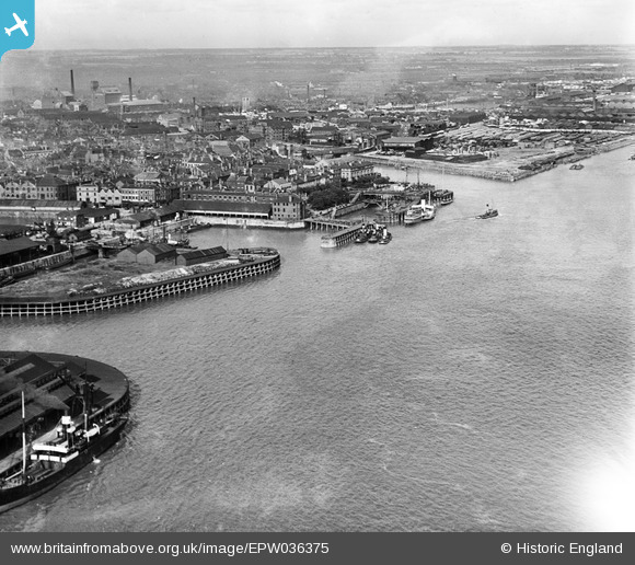
EPW036375 ENGLAND (1931). The Humber Dock Basin, Victoria Pier and the River Humber, Kingston upon Hull, from the south-west, 1931
© Hawlfraint cyfranwyr OpenStreetMap a thrwyddedwyd gan yr OpenStreetMap Foundation. 2026. Trwyddedir y gartograffeg fel CC BY-SA.
Delweddau cyfagos (3)
EPW036375

EAW004514

EPW036412

Manylion
| Pennawd | [EPW036375] The Humber Dock Basin, Victoria Pier and the River Humber, Kingston upon Hull, from the south-west, 1931 |
| Cyfeirnod | EPW036375 |
| Dyddiad | August-1931 |
| Dolen | |
| Enw lle | KINGSTON UPON HULL |
| Plwyf | |
| Ardal | |
| Gwlad | ENGLAND |
| Dwyreiniad / Gogleddiad | 509767, 427894 |
| Hydred / Lledred | -0.33572894180963, 53.735642933765 |
| Cyfeirnod Grid Cenedlaethol | TA098279 |
Pinnau
Byddwch y cyntaf i ychwanegu sylw at y ddelwedd hon!