
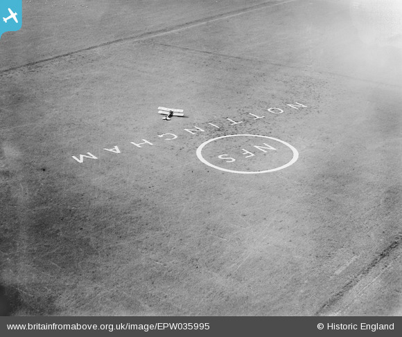
EPW035995 ENGLAND (1931). DH.60M Moth G-AALG landing near National Flying Services Circle at Tollerton Airfield, Tollerton, 1931
© Hawlfraint cyfranwyr OpenStreetMap a thrwyddedwyd gan yr OpenStreetMap Foundation. 2026. Trwyddedir y gartograffeg fel CC BY-SA.
Delweddau cyfagos (9)
EPW035995

EPW034046

EPW034043

EPW035993

EPW035994

EPW034045
 in hangar, Tollerton, 1930. This image has been affected by flare.")
EPW034048

EPW034044

EPW034047

Manylion
| Pennawd | [EPW035995] DH.60M Moth G-AALG landing near National Flying Services Circle at Tollerton Airfield, Tollerton, 1931 |
| Cyfeirnod | EPW035995 |
| Dyddiad | July-1931 |
| Dolen | |
| Enw lle | TOLLERTON |
| Plwyf | TOLLERTON |
| Ardal | |
| Gwlad | ENGLAND |
| Dwyreiniad / Gogleddiad | 461993, 336186 |
| Hydred / Lledred | -1.0778740010997, 52.919192319719 |
| Cyfeirnod Grid Cenedlaethol | SK620362 |
Pinnau
Byddwch y cyntaf i ychwanegu sylw at y ddelwedd hon!