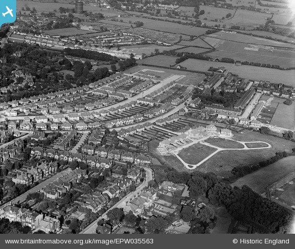
EPW035563 ENGLAND (1931). Housing surrounding Broadmead Road, Mayfair Gardens and environs, Woodford, 1931
    © Hawlfraint cyfranwyr OpenStreetMap a thrwyddedwyd gan yr OpenStreetMap Foundation. 2025. Trwyddedir y gartograffeg fel CC BY-SA.
  
Manylion
| Pennawd | [EPW035563] Housing surrounding Broadmead Road, Mayfair Gardens and environs, Woodford, 1931 | 
| Cyfeirnod | EPW035563 | 
| Dyddiad | July-1931 | 
| Dolen | |
| Enw lle | WOODFORD | 
| Plwyf | |
| Ardal | |
| Gwlad | ENGLAND | 
| Dwyreiniad / Gogleddiad | 540423, 191465 | 
| Hydred / Lledred | 0.027925033055843, 51.604019804455 | 
| Cyfeirnod Grid Cenedlaethol | TQ404915 | 
Pinnau
|  Now the route of the M11 motorway |   Mikeya | Tuesday 30th of June 2020 07:59:05 PM | 
|  Woodford Bridge gas works |   Mikeya | Tuesday 30th of June 2020 07:58:22 PM | 
|  Site of later viaduct over railway constructed to allow closure of Snakes Lane level crossing as part of the electrification of the Ongar branch as part of the Central line extension c1938 - 46. |   Mikeya | Thursday 20th of April 2017 10:27:07 PM | 
|  LNER steam locomotive leading a train heading east approaching Woodford station. |   Mikeya | Thursday 20th of April 2017 10:19:52 PM | 
|  Snakes Lane East |   Mikeya | Thursday 20th of April 2017 10:18:06 PM | 
 
             
  ![[EPW035563] Housing surrounding Broadmead Road, Mayfair Gardens and environs, Woodford, 1931](http://britainfromabove.org.uk/sites/all/libraries/aerofilms-images/public/100x100/EPW/035/EPW035563.jpg) 
  
                                          ![[EPW035562] Housing surrounding Broadmead Road and Mayfair Gardens, Woodford, 1931](http://britainfromabove.org.uk/sites/all/libraries/aerofilms-images/public/100x100/EPW/035/EPW035562.jpg) 
 ![[EPW035564] Housing surrounding Broadmead Road, Mayfair Gardens and environs, Woodford, from the west, 1931](http://britainfromabove.org.uk/sites/all/libraries/aerofilms-images/public/100x100/EPW/035/EPW035564.jpg)