
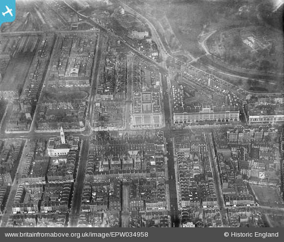
EPW034958 ENGLAND (1931). Berkeley Court, Baker Street and environs, Marylebone, 1931
© Hawlfraint cyfranwyr OpenStreetMap a thrwyddedwyd gan yr OpenStreetMap Foundation. 2026. Trwyddedir y gartograffeg fel CC BY-SA.
Delweddau cyfagos (22)
EPW034958

EPW034954

EPW034995

EPW034995
EPW034996

EPW034996
EPW034953

EPW034991

EPW034991
EPW034957

EPW034994

EPW034994
EPW034990

EPW034990
EPW034956

EPW034955

EPW034992

EPW034992
EPW034993

EPW034993
EPW044586

EPW008740

Manylion
| Pennawd | [EPW034958] Berkeley Court, Baker Street and environs, Marylebone, 1931 |
| Cyfeirnod | EPW034958 |
| Dyddiad | April-1931 |
| Dolen | |
| Enw lle | MARYLEBONE |
| Plwyf | |
| Ardal | |
| Gwlad | ENGLAND |
| Dwyreiniad / Gogleddiad | 527870, 181973 |
| Hydred / Lledred | -0.15670719472444, 51.521699048076 |
| Cyfeirnod Grid Cenedlaethol | TQ279820 |
Pinnau

The Laird |
Monday 25th of July 2016 09:58:58 AM | |
|
TinyTim |
Thursday 30th of July 2015 09:13:38 PM | |

Class31 |
Monday 19th of January 2015 10:46:40 PM | |
|
Class31 |
Saturday 14th of June 2014 09:34:09 PM | |
|
Class31 |
Saturday 14th of June 2014 09:33:31 PM |

Cyfraniadau Grŵp

Chiltern Court and Baker Street Station, Marylebone Road, 18/02/2014 |
Class31 |
Saturday 7th of May 2016 08:20:12 AM |