
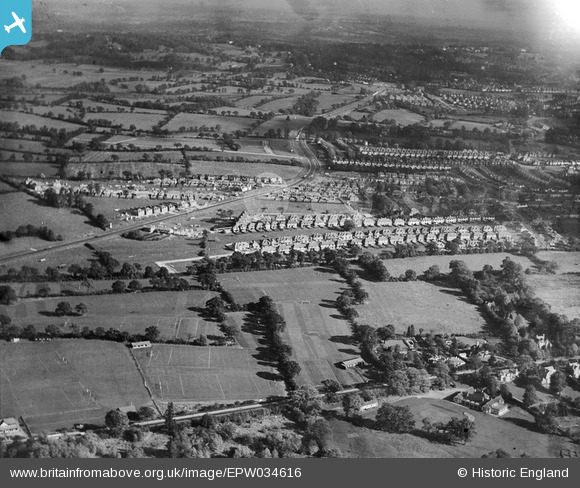
EPW034616 ENGLAND (1930). Housing development around Green Lane, Edgware, from the south-west, 1930
© Hawlfraint cyfranwyr OpenStreetMap a thrwyddedwyd gan yr OpenStreetMap Foundation. 2026. Trwyddedir y gartograffeg fel CC BY-SA.
Delweddau cyfagos (4)
EPW034616

EPW034617

EAW027664
 in flight over the Edgwarebury Park area, Edgware, from the south-west, 1949")
EPW061140

Manylion
| Pennawd | [EPW034616] Housing development around Green Lane, Edgware, from the south-west, 1930 |
| Cyfeirnod | EPW034616 |
| Dyddiad | 16-October-1930 |
| Dolen | |
| Enw lle | EDGWARE |
| Plwyf | |
| Ardal | |
| Gwlad | ENGLAND |
| Dwyreiniad / Gogleddiad | 518620, 192648 |
| Hydred / Lledred | -0.28637799114726, 51.619668895643 |
| Cyfeirnod Grid Cenedlaethol | TQ186926 |
Pinnau

Lee P |
Thursday 26th of November 2015 09:11:08 AM |