
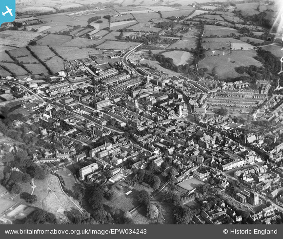
EPW034243 ENGLAND (1930). The town centre, Leek, from the north-west, 1930
© Hawlfraint cyfranwyr OpenStreetMap a thrwyddedwyd gan yr OpenStreetMap Foundation. 2026. Trwyddedir y gartograffeg fel CC BY-SA.
Delweddau cyfagos (2)
EPW034243

EPW034242

Manylion
| Pennawd | [EPW034243] The town centre, Leek, from the north-west, 1930 |
| Cyfeirnod | EPW034243 |
| Dyddiad | July-1930 |
| Dolen | |
| Enw lle | LEEK |
| Plwyf | LEEK |
| Ardal | |
| Gwlad | ENGLAND |
| Dwyreiniad / Gogleddiad | 398483, 356703 |
| Hydred / Lledred | -2.0226629144311, 53.107220142134 |
| Cyfeirnod Grid Cenedlaethol | SJ985567 |
