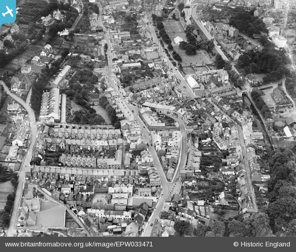
EPW033471 ENGLAND (1930). Orchard Gardens, Park Road and The Lawn, Dawlish, 1930
© Hawlfraint cyfranwyr OpenStreetMap a thrwyddedwyd gan yr OpenStreetMap Foundation. 2026. Trwyddedir y gartograffeg fel CC BY-SA.
Delweddau cyfagos (6)
Manylion
| Pennawd | [EPW033471] Orchard Gardens, Park Road and The Lawn, Dawlish, 1930 |
| Cyfeirnod | EPW033471 |
| Dyddiad | July-1930 |
| Dolen | |
| Enw lle | DAWLISH |
| Plwyf | DAWLISH |
| Ardal | |
| Gwlad | ENGLAND |
| Dwyreiniad / Gogleddiad | 295830, 76807 |
| Hydred / Lledred | -3.4715095782972, 50.581109227441 |
| Cyfeirnod Grid Cenedlaethol | SX958768 |
Pinnau

Class31 |
Saturday 21st of June 2014 04:42:31 PM | |

Class31 |
Saturday 21st of June 2014 04:41:18 PM | |

Class31 |
Saturday 21st of June 2014 04:40:37 PM | |

Class31 |
Saturday 21st of June 2014 04:39:43 PM | |

Class31 |
Saturday 21st of June 2014 04:38:56 PM | |

Class31 |
Saturday 21st of June 2014 04:38:20 PM | |

Class31 |
Saturday 21st of June 2014 04:37:34 PM | |

Class31 |
Saturday 21st of June 2014 04:36:49 PM | |

Class31 |
Saturday 21st of June 2014 04:35:53 PM |


![[EPW033471] Orchard Gardens, Park Road and The Lawn, Dawlish, 1930](http://britainfromabove.org.uk/sites/all/libraries/aerofilms-images/public/100x100/EPW/033/EPW033471.jpg)
![[EPW033469] The town centre, Dawlish, 1930. This image has been affected by flare.](http://britainfromabove.org.uk/sites/all/libraries/aerofilms-images/public/100x100/EPW/033/EPW033469.jpg)
![[EPW023672] The town centre, Dawlish, 1928.](http://britainfromabove.org.uk/sites/all/libraries/aerofilms-images/public/100x100/EPW/023/EPW023672.jpg)
![[EPW033470] The town and surrounding countryside, Dawlish, 1930](http://britainfromabove.org.uk/sites/all/libraries/aerofilms-images/public/100x100/EPW/033/EPW033470.jpg)
![[EPW023661] The town centre, Dawlish, 1928.](http://britainfromabove.org.uk/sites/all/libraries/aerofilms-images/public/100x100/EPW/023/EPW023661.jpg)
![[EAW015001] The town, Dawlish, 1948. This image has been produced from a print.](http://britainfromabove.org.uk/sites/all/libraries/aerofilms-images/public/100x100/EAW/015/EAW015001.jpg)