
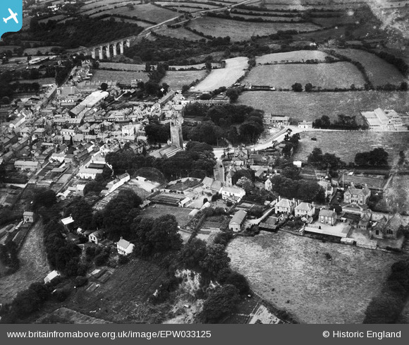
EPW033125 ENGLAND (1930). St Peter and St Paul's Church and environs, Holsworthy, 1930
© Hawlfraint cyfranwyr OpenStreetMap a thrwyddedwyd gan yr OpenStreetMap Foundation. 2026. Trwyddedir y gartograffeg fel CC BY-SA.
Delweddau cyfagos (3)
EPW033125

EPW033124

EPW033127

Manylion
| Pennawd | [EPW033125] St Peter and St Paul's Church and environs, Holsworthy, 1930 |
| Cyfeirnod | EPW033125 |
| Dyddiad | July-1930 |
| Dolen | |
| Enw lle | HOLSWORTHY |
| Plwyf | HOLSWORTHY |
| Ardal | |
| Gwlad | ENGLAND |
| Dwyreiniad / Gogleddiad | 234383, 103939 |
| Hydred / Lledred | -4.3510456440381, 50.810730590921 |
| Cyfeirnod Grid Cenedlaethol | SS344039 |
Pinnau

Class31 |
Saturday 22nd of December 2012 07:39:53 PM | |
|
Class31 |
Saturday 22nd of December 2012 07:26:20 PM | |
|
Class31 |
Saturday 22nd of December 2012 07:24:56 PM | |
|
Class31 |
Saturday 22nd of December 2012 07:22:26 PM | |
|
Class31 |
Saturday 22nd of December 2012 07:21:52 PM | |
|
Class31 |
Saturday 22nd of December 2012 07:20:35 PM | |
|
Class31 |
Saturday 22nd of December 2012 07:20:05 PM | |
|
Class31 |
Saturday 22nd of December 2012 07:19:40 PM | |

Maurice |
Saturday 22nd of December 2012 11:48:12 AM |
Cyfraniadau Grŵp
Another shot of Derriton Viaduct - Holsworthy |
Maurice |
Saturday 22nd of December 2012 11:48:49 AM |