
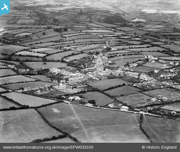
EPW033100 ENGLAND (1930). The village and environs, Bere Alston, 1930
© Hawlfraint cyfranwyr OpenStreetMap a thrwyddedwyd gan yr OpenStreetMap Foundation. 2026. Trwyddedir y gartograffeg fel CC BY-SA.
Delweddau cyfagos (4)
EPW033100

EPW033098

EPW033101

EPW033099

Manylion
| Pennawd | [EPW033100] The village and environs, Bere Alston, 1930 |
| Cyfeirnod | EPW033100 |
| Dyddiad | July-1930 |
| Dolen | |
| Enw lle | BERE ALSTON |
| Plwyf | BERE FERRERS |
| Ardal | |
| Gwlad | ENGLAND |
| Dwyreiniad / Gogleddiad | 244736, 66756 |
| Hydred / Lledred | -4.1886108044409, 50.479427295241 |
| Cyfeirnod Grid Cenedlaethol | SX447668 |
Pinnau

Railway Routes |
Monday 15th of July 2024 03:18:35 PM | |
|
TLeverton@aol.com |
Wednesday 11th of September 2013 12:51:34 PM | |
|
TLeverton@aol.com |
Wednesday 11th of September 2013 12:50:41 PM | |
|
TLeverton@aol.com |
Wednesday 11th of September 2013 12:50:13 PM |