
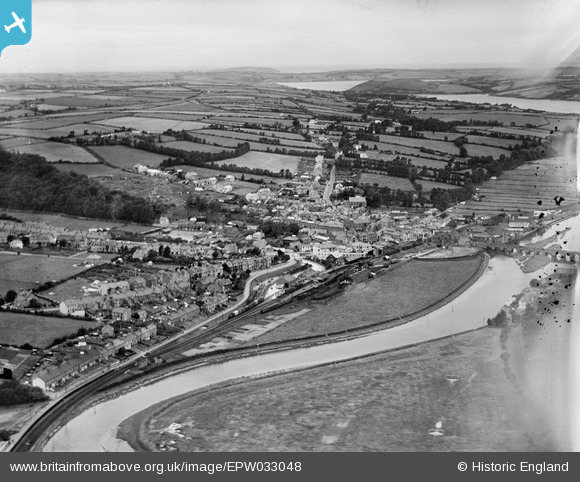
EPW033048 ENGLAND (1930). The railway station, town and surrounding countryside, Wadebridge, from the east, 1930
© Hawlfraint cyfranwyr OpenStreetMap a thrwyddedwyd gan yr OpenStreetMap Foundation. 2026. Trwyddedir y gartograffeg fel CC BY-SA.
Delweddau cyfagos (4)
EPW033048

EPW039815

EPW033052

EPW039812

Manylion
| Pennawd | [EPW033048] The railway station, town and surrounding countryside, Wadebridge, from the east, 1930 |
| Cyfeirnod | EPW033048 |
| Dyddiad | July-1930 |
| Dolen | |
| Enw lle | WADEBRIDGE |
| Plwyf | WADEBRIDGE |
| Ardal | |
| Gwlad | ENGLAND |
| Dwyreiniad / Gogleddiad | 199263, 72198 |
| Hydred / Lledred | -4.831786748052, 50.514504789882 |
| Cyfeirnod Grid Cenedlaethol | SW993722 |
Pinnau

ronS |
Saturday 24th of August 2013 02:20:55 AM | |
|
ronS |
Saturday 24th of August 2013 02:17:46 AM | |
|
ronS |
Saturday 24th of August 2013 02:15:02 AM | |
|
ronS |
Saturday 24th of August 2013 02:14:32 AM | |
|
ronS |
Saturday 24th of August 2013 02:13:27 AM | |
|
ronS |
Saturday 24th of August 2013 02:12:56 AM |