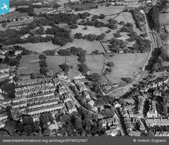
EPW032967 ENGLAND (1930). Claremont Road and environs, Royal Tunbridge Wells, 1930
    © Hawlfraint cyfranwyr OpenStreetMap a thrwyddedwyd gan yr OpenStreetMap Foundation. 2025. Trwyddedir y gartograffeg fel CC BY-SA.
  
Delweddau cyfagos (22)
Manylion
| Pennawd | [EPW032967] Claremont Road and environs, Royal Tunbridge Wells, 1930 | 
| Cyfeirnod | EPW032967 | 
| Dyddiad | July-1930 | 
| Dolen | |
| Enw lle | ROYAL TUNBRIDGE WELLS | 
| Plwyf | |
| Ardal | |
| Gwlad | ENGLAND | 
| Dwyreiniad / Gogleddiad | 558759, 138785 | 
| Hydred / Lledred | 0.26898672707987, 51.125788168194 | 
| Cyfeirnod Grid Cenedlaethol | TQ588388 | 
Pinnau
Byddwch y cyntaf i ychwanegu sylw at y ddelwedd hon!
 
             
  ![[EPW032967] Claremont Road and environs, Royal Tunbridge Wells, 1930](http://britainfromabove.org.uk/sites/all/libraries/aerofilms-images/public/100x100/EPW/032/EPW032967.jpg) 
  
                                          ![[EPW032962] Madeira Park and environs, Royal Tunbridge Wells, 1930](http://britainfromabove.org.uk/sites/all/libraries/aerofilms-images/public/100x100/EPW/032/EPW032962.jpg) 
 ![[EPW032968] Madeira Park, Claremont Road and environs, Royal Tunbridge Wells, 1930](http://britainfromabove.org.uk/sites/all/libraries/aerofilms-images/public/100x100/EPW/032/EPW032968.jpg) 
 ![[EPW032961] Claremont Road and environs, Royal Tunbridge Wells, 1930](http://britainfromabove.org.uk/sites/all/libraries/aerofilms-images/public/100x100/EPW/032/EPW032961.jpg) 
 ![[EPW032963] Madeira Park, Claremont Road and environs, Royal Tunbridge Wells, 1930](http://britainfromabove.org.uk/sites/all/libraries/aerofilms-images/public/100x100/EPW/032/EPW032963.jpg) 
 ![[EPW032959] Claremont Road and environs, Royal Tunbridge Wells, 1930](http://britainfromabove.org.uk/sites/all/libraries/aerofilms-images/public/100x100/EPW/032/EPW032959.jpg) 
 ![[EPW032965] Nevill Cricket and Athletic Ground, Claremont Road and environs,  Royal Tunbridge Wells, 1930](http://britainfromabove.org.uk/sites/all/libraries/aerofilms-images/public/100x100/EPW/032/EPW032965.jpg) 
 ![[EPW032960] Nevill Cricket and Athletic Ground and housing around Arundel Road, Royal Tunbridge Wells, 1930](http://britainfromabove.org.uk/sites/all/libraries/aerofilms-images/public/100x100/EPW/032/EPW032960.jpg) 
 ![[EPW032964] Claremont Road and environs, Royal Tunbridge Wells, 1930](http://britainfromabove.org.uk/sites/all/libraries/aerofilms-images/public/100x100/EPW/032/EPW032964.jpg) 
 ![[EAW053167] Banner Farm Estate in the early stages of construction, Tunbridge Wells Common and environs, Royal Tunbridge Wells, 1954](http://britainfromabove.org.uk/sites/all/libraries/aerofilms-images/public/100x100/EAW/053/EAW053167.jpg) 
 ![[EPW032966] Nevill Cricket and Athletic Ground, Cambridge Gardens and environs, Royal Tunbridge Wells, 1930](http://britainfromabove.org.uk/sites/all/libraries/aerofilms-images/public/100x100/EPW/032/EPW032966.jpg) 
 ![[EAW053175] Banner Farm Estate in the early stages of construction, Tunbridge Wells Common and environs, Royal Tunbridge Wells, 1954](http://britainfromabove.org.uk/sites/all/libraries/aerofilms-images/public/100x100/EAW/053/EAW053175.jpg) 
 ![[EAW053171] Banner Farm Estate in the early stages of construction, Tunbridge Wells Common and environs, Royal Tunbridge Wells, 1954](http://britainfromabove.org.uk/sites/all/libraries/aerofilms-images/public/100x100/EAW/053/EAW053171.jpg) 
 ![[EAW053176] Banner Farm Estate in the early stages of construction, Royal Tunbridge Wells, 1954](http://britainfromabove.org.uk/sites/all/libraries/aerofilms-images/public/100x100/EAW/053/EAW053176.jpg) 
 ![[EAW053173] Banner Farm Estate in the early stages of construction, Royal Tunbridge Wells, 1954](http://britainfromabove.org.uk/sites/all/libraries/aerofilms-images/public/100x100/EAW/053/EAW053173.jpg) 
 ![[EAW053168] Banner Farm Estate in the early stages of construction, Royal Tunbridge Wells, 1954](http://britainfromabove.org.uk/sites/all/libraries/aerofilms-images/public/100x100/EAW/053/EAW053168.jpg) 
 ![[EAW053174] Banner Farm Estate in the early stages of construction, Royal Tunbridge Wells, 1954](http://britainfromabove.org.uk/sites/all/libraries/aerofilms-images/public/100x100/EAW/053/EAW053174.jpg) 
 ![[EAW053172] Banner Farm Estate in the early stages of construction, Royal Tunbridge Wells, 1954](http://britainfromabove.org.uk/sites/all/libraries/aerofilms-images/public/100x100/EAW/053/EAW053172.jpg) 
 ![[EPW032970] The Grove and environs, Royal Tunbridge Wells, 1930](http://britainfromabove.org.uk/sites/all/libraries/aerofilms-images/public/100x100/EPW/032/EPW032970.jpg) 
 ![[EPW032971] The town around Calverley Park, Royal Tunbridge Wells, from the south-west, 1930](http://britainfromabove.org.uk/sites/all/libraries/aerofilms-images/public/100x100/EPW/032/EPW032971.jpg) 
 ![[EPW032969] Calverley Park and environs, Royal Tunbridge Wells, 1930](http://britainfromabove.org.uk/sites/all/libraries/aerofilms-images/public/100x100/EPW/032/EPW032969.jpg) 
 ![[EAW053169] Banner Farm Estate in the early stages of construction and environs, Royal Tunbridge Wells, 1954](http://britainfromabove.org.uk/sites/all/libraries/aerofilms-images/public/100x100/EAW/053/EAW053169.jpg)