
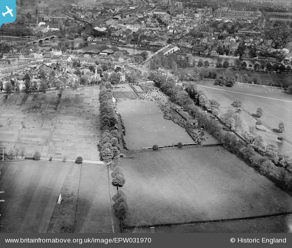
EPW031970 ENGLAND (1930). The King's Field Recreation Ground and environs, Hampton Wick, from the south-west, 1930
© Hawlfraint cyfranwyr OpenStreetMap a thrwyddedwyd gan yr OpenStreetMap Foundation. 2026. Trwyddedir y gartograffeg fel CC BY-SA.
Delweddau cyfagos (8)
EPW031970

EPW031971

EPW031974

EPW031969

EPW031973

EPW031975

EPW031976

EPW031972

Manylion
| Pennawd | [EPW031970] The King's Field Recreation Ground and environs, Hampton Wick, from the south-west, 1930 |
| Cyfeirnod | EPW031970 |
| Dyddiad | 12-May-1930 |
| Dolen | |
| Enw lle | HAMPTON WICK |
| Plwyf | |
| Ardal | |
| Gwlad | ENGLAND |
| Dwyreiniad / Gogleddiad | 517169, 169323 |
| Hydred / Lledred | -0.31508492433757, 51.410314405215 |
| Cyfeirnod Grid Cenedlaethol | TQ172693 |
