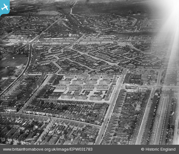
EPW031783 ENGLAND (1930). The Cleverly Estate, Shepherd's Bush, from the south-east, 1930
    © Hawlfraint cyfranwyr OpenStreetMap a thrwyddedwyd gan yr OpenStreetMap Foundation. 2025. Trwyddedir y gartograffeg fel CC BY-SA.
  
Delweddau cyfagos (5)
Manylion
| Pennawd | [EPW031783] The Cleverly Estate, Shepherd's Bush, from the south-east, 1930 | 
| Cyfeirnod | EPW031783 | 
| Dyddiad | May-1930 | 
| Dolen | |
| Enw lle | SHEPHERD'S BUSH | 
| Plwyf | |
| Ardal | |
| Gwlad | ENGLAND | 
| Dwyreiniad / Gogleddiad | 522127, 180333 | 
| Hydred / Lledred | -0.24001996036335, 51.508229614667 | 
| Cyfeirnod Grid Cenedlaethol | TQ221803 | 
 
             
  ![[EPW031783] The Cleverly Estate, Shepherd's Bush, from the south-east, 1930](http://britainfromabove.org.uk/sites/all/libraries/aerofilms-images/public/100x100/EPW/031/EPW031783.jpg) 
  
                                          ![[EPW031782] The Cleverly Estate, Shepherd's Bush, from the south-east, 1930](http://britainfromabove.org.uk/sites/all/libraries/aerofilms-images/public/100x100/EPW/031/EPW031782.jpg) 
 ![[EPW031781] The Cleverly Estate, Shepherd's Bush, from the south-east, 1930](http://britainfromabove.org.uk/sites/all/libraries/aerofilms-images/public/100x100/EPW/031/EPW031781.jpg) 
 ![[EPW031780] The Cleverly Estate, Shepherd's Bush, from the south-east, 1930](http://britainfromabove.org.uk/sites/all/libraries/aerofilms-images/public/100x100/EPW/031/EPW031780.jpg) 
 ![[EPW031785] The Cleverly Estate, Shepherd's Bush, from the south-west, 1930](http://britainfromabove.org.uk/sites/all/libraries/aerofilms-images/public/100x100/EPW/031/EPW031785.jpg) 
  Old Oak Rd
W12
 Old Oak Rd
W12