
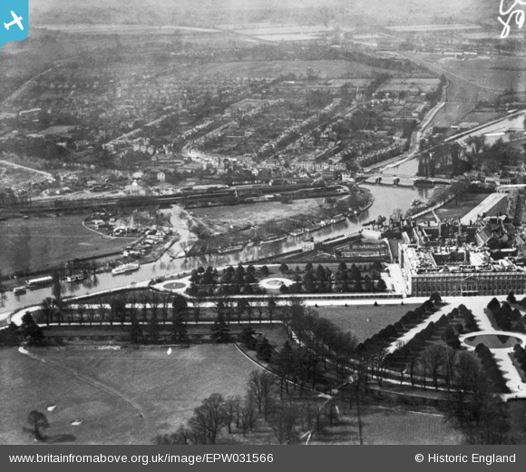
EPW031566 ENGLAND (1930). Hampton Court Palace and Park looking towards Hampton Court Station, Hampton Court Park, from the east, 1930. This image has been produced from a print.
© Hawlfraint cyfranwyr OpenStreetMap a thrwyddedwyd gan yr OpenStreetMap Foundation. 2026. Trwyddedir y gartograffeg fel CC BY-SA.
Delweddau cyfagos (30)
EPW031566

EPW001713

EAW014186

EPW001711

EAW014185

EPW001712

EPW010997

EAW014181

EPW022946

EPW022853

EAW023684

EPW022852

EPW060551

EAW014184

EPW009439

EPW049573

EAW002300

EPW060550

EPW022848

EAW023683

EAW014182

EPW060552

EAW018711

EAW018712

EPW008866

EPW001716

EAW003680

EPW060549

EPW049608

EAW002302

Manylion
| Pennawd | [EPW031566] Hampton Court Palace and Park looking towards Hampton Court Station, Hampton Court Park, from the east, 1930. This image has been produced from a print. |
| Cyfeirnod | EPW031566 |
| Dyddiad | February-1930 |
| Dolen | |
| Enw lle | HAMPTON COURT PARK |
| Plwyf | |
| Ardal | |
| Gwlad | ENGLAND |
| Dwyreiniad / Gogleddiad | 515787, 168269 |
| Hydred / Lledred | -0.33529343776296, 51.401124094587 |
| Cyfeirnod Grid Cenedlaethol | TQ158683 |
Pinnau
Byddwch y cyntaf i ychwanegu sylw at y ddelwedd hon!