
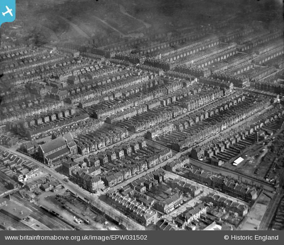
EPW031502 ENGLAND (1930). St Paul's Church and terraced housing surrounding Burgoyne Road, Umfreville Road and Cavendish Road, Harringay, 1930
© Hawlfraint cyfranwyr OpenStreetMap a thrwyddedwyd gan yr OpenStreetMap Foundation. 2026. Trwyddedir y gartograffeg fel CC BY-SA.
Delweddau cyfagos (2)
EPW031502

EPW031662

Manylion
| Pennawd | [EPW031502] St Paul's Church and terraced housing surrounding Burgoyne Road, Umfreville Road and Cavendish Road, Harringay, 1930 |
| Cyfeirnod | EPW031502 |
| Dyddiad | February-1930 |
| Dolen | |
| Enw lle | HARRINGAY |
| Plwyf | |
| Ardal | |
| Gwlad | ENGLAND |
| Dwyreiniad / Gogleddiad | 531644, 188323 |
| Hydred / Lledred | -0.099958531841013, 51.577902423747 |
| Cyfeirnod Grid Cenedlaethol | TQ316883 |
Pinnau

Class31 |
Wednesday 13th of February 2013 03:05:20 PM | |
|
Class31 |
Wednesday 13th of February 2013 03:04:57 PM | |
|
Class31 |
Wednesday 13th of February 2013 03:04:29 PM | |
|
Class31 |
Wednesday 13th of February 2013 03:03:48 PM | |
|
Class31 |
Wednesday 13th of February 2013 03:03:16 PM | |
|
Class31 |
Wednesday 13th of February 2013 03:00:35 PM | |
|
Class31 |
Wednesday 13th of February 2013 02:54:58 PM | |
|
Class31 |
Wednesday 13th of February 2013 02:54:24 PM | |
|
Class31 |
Wednesday 13th of February 2013 02:53:40 PM | |
|
Class31 |
Wednesday 13th of February 2013 02:52:32 PM |