
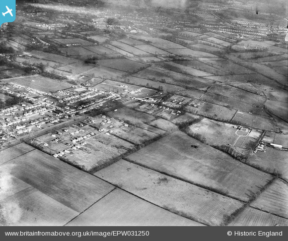
EPW031250 ENGLAND (1930). Fieldend Road and environs, Eastcote, from the south-west, 1930
© Hawlfraint cyfranwyr OpenStreetMap a thrwyddedwyd gan yr OpenStreetMap Foundation. 2026. Trwyddedir y gartograffeg fel CC BY-SA.
Delweddau cyfagos (2)
EPW031250

EPW031247

Manylion
| Pennawd | [EPW031250] Fieldend Road and environs, Eastcote, from the south-west, 1930 |
| Cyfeirnod | EPW031250 |
| Dyddiad | 7-February-1930 |
| Dolen | |
| Enw lle | EASTCOTE |
| Plwyf | |
| Ardal | |
| Gwlad | ENGLAND |
| Dwyreiniad / Gogleddiad | 510788, 187081 |
| Hydred / Lledred | -0.40123068310512, 51.571224475267 |
| Cyfeirnod Grid Cenedlaethol | TQ108871 |
Pinnau

Class31 |
Saturday 5th of January 2013 09:28:54 AM | |

Linda |
Tuesday 11th of December 2012 11:45:30 AM | |
|
Class31 |
Saturday 20th of October 2012 10:06:23 PM | |
|
Class31 |
Friday 19th of October 2012 08:37:07 PM | |
|
Class31 |
Friday 19th of October 2012 08:36:31 PM | |
|
Class31 |
Friday 19th of October 2012 08:36:08 PM | |
|
Class31 |
Friday 19th of October 2012 08:35:42 PM | |
|
Class31 |
Friday 19th of October 2012 08:35:12 PM | |
|
Class31 |
Friday 19th of October 2012 08:21:16 PM | |
|
Class31 |
Friday 19th of October 2012 08:20:44 PM | |
|
Class31 |
Friday 19th of October 2012 08:19:22 PM | |
|
Class31 |
Friday 19th of October 2012 08:19:06 PM | |
|
Class31 |
Thursday 18th of October 2012 09:16:00 PM | |
|
Class31 |
Thursday 18th of October 2012 09:15:39 PM |
Cyfraniadau Grŵp
It's no good adding all these identifications if you don't name the town and county! Please do! If you don't know how to do it in the boxes, just add a comment with the location. |
Nicholas Reed |
Monday 22nd of October 2012 11:45:18 AM |
I'm not sure what I have done wrong but it is possible to locate the image from the box which gives the adninistrative area. Until I identified it no one knew where it was! |
Class31 |
Monday 22nd of October 2012 11:45:18 AM |